How Denver’s zoning and land use changes sparked rapid neighborhood change and school instability: a longitudinal analysis from 2000 to 2026
2020–present
Abstract
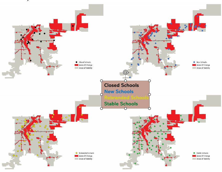
Over the past two decades, rezoning, redevelopment, and rapid growth remade many of Denver’s neighborhoods, and with them the public schools that serve them. This project examines how zoning and land use decisions, neighborhood change, and school change are linked, and how decisions made in one domain ripple through the others.
The study builds a long-term spatial database that connects Denver’s historical zoning layers to county assessor parcel records, multiple Census series, transit data, and school-level data. With Gracen Alleman, a current graduate student, we are using Python and AI-assisted tools to parse zoning code text into structured data, translating dimensional standards and use permissions into a database that can be linked across years, and paired with a longitudinal Census data set Gracen created with consistent block group boundries. Interviews with school principals and city planners explain the decisions behind upzoning and the actions later taken to reverse its harms.
The data show multi-directional patterns of neighborhood and school change. The project builds on my earlier comparative research on urban school districts and neighborhood development, and on the integration of school planning into urban planning practice and education. Publications and presentations from this project will be posted here as they become available.

