Generalized Zoning for the Denver Metro 8-County Area
Funded by a CU Denver Presidential Initiative on Urban and Place-Based Research grant, 2022–2024 · Interactive StoryMap created with the CU Denver GAMLab
Abstract
Zoning in the Denver metropolitan region is written and administered by dozens of separate cities, towns, and counties, each with its own district names, definitions, and standards. That fragmentation makes basic regional questions surprisingly hard to answer: Where is multifamily housing allowed? How much land is reserved for detached single-family homes? Where do zoning rules line up, or fail to line up, with transit, jobs, and growth?
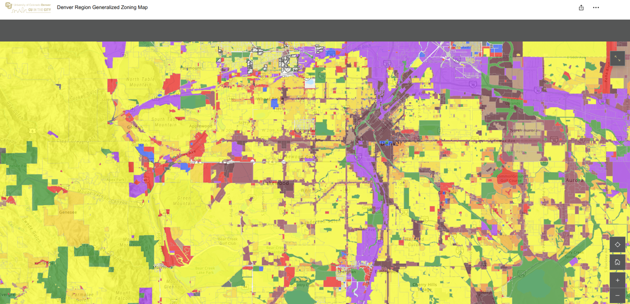
To answer those questions, my research team built a generalized zoning dataset for the eight-county Denver metro area. We translated each jurisdiction’s base zoning districts into a common set of standardized categories and mapped them to parcels in GIS, producing a single regional layer that can be compared across municipal boundaries. The dataset was developed for the larger study, Seeking Housing Affordability in the Denver Metro Area, and has informed analyses of housing supply, zoning near rail transit, and the mismatch between household sizes and the housing types the region permits. It also laid groundwork for my role as the initial Colorado State Lead for the National Zoning Atlas.
The interactive StoryMap explains the standardized zoning definitions and lets users explore the data parcel by parcel. The full GIS dataset is available upon request.

